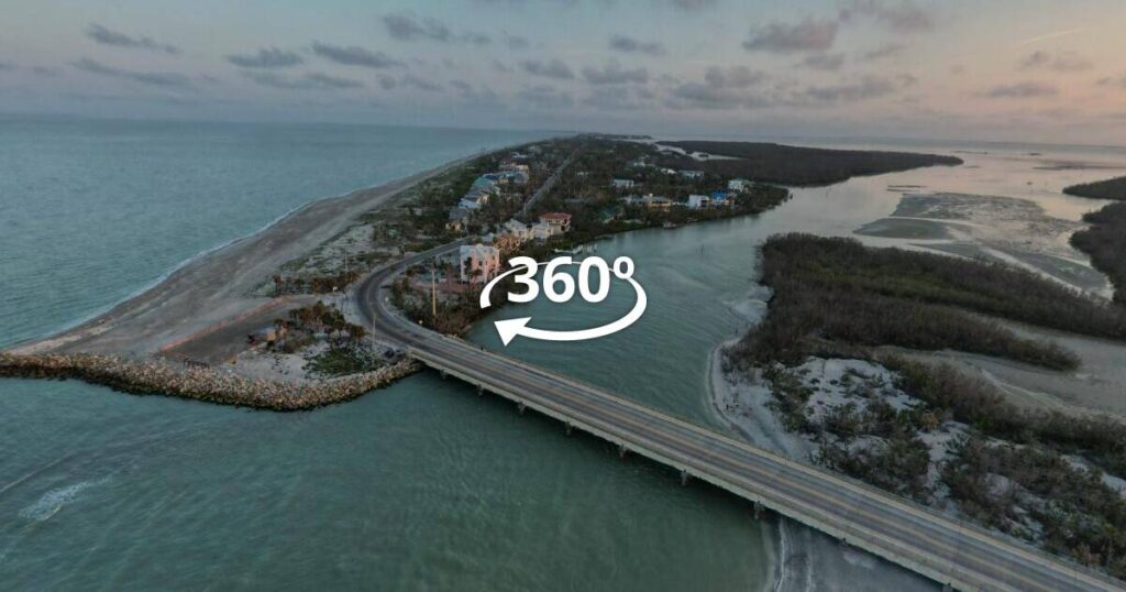
Unified Web Media

  • Projects
  • Contact
  • About Us

  • Google Street View Updates
  • Step Inside Your Business on Google Maps

76ers Fieldhouse

This tour consists of over 3 dozen high resolution 360 images that have been published on a privately hosted site and syndicated across Google Maps, Earth, and Street View.

Click Image to Start Tour

Christina River Bridge

Newly constructed bridge on the Christina River now visible on Google Maps, Earth and Street View. New to Street View ? Have a look at our Beginners Tutorial.

East Fairmount Park Reservoir

We recently collected navigable Street View images of the new trail and Outward Bound training course alongside a previously inaccessible reservoir in Fairmount Park. Great spot for a getaway hike just outside Center City just across from Smith Memorial Playground. Preview the hike with the embedded Google Maps link below. Navigate by clicking and dragging with your mouse or using these keys  W – forward , S – back, A – left , D – right.

New to Street View ? Watch our short video of Street View Tips.

<i

Philadelphia Navy Yard

Updated Google Street View images for Admiral Peary Way on the Navy Yard Waterfront and encountered The Kraken along the way. Fall foliage provided an excellent backdrop for this project.

Tap or Click Image to Enlarge

South Jersey Boardwalks

This summer we have been busy trekking the boardwalks of Wildwood, Ocean City, Ventnor and Atlantic City for Google Street View. Here are direct links that allow you to interact with all of the “blue lines”. Take a stroll around by clicking and dragging with your mouse or using these keys  W – forward , S – back, A – left , D – right.

New to Street View ? Watch our short video of Street View Tips.

Wildwood and Wildwood Crest (2.5 miles)

Ocean City (2.45 miles)

Ventnor (1.6 miles)

Atlantic City (4 miles)

Atlantic City North Beach Extension (.5 miles)

Corsons Inlet State Park

Street View abruptly ended at 59th Street and Central Ave. in Ocean City NJ so we deployed our Street View Trekker to extend Google Maps into Corsons Inlet and connect our fresh blue line to the images that Google created in September of 2013.

Before Street View Extension – Click to Enlarge
After Street View Extension – Click to Enlarge
  • 1
  • 2
  • 3
  • Next Page »

Featured Projects

  • Claymont Renaissance
  • City Winery Philadelphia
  • Delaware Pinball Collective
  • The Grand Opera House
  • Arden Swim Club
  • 76ers Fieldhouse
  • Alapocas Run State Park
  • Levante Brewing
  • Christina River Bridge
  • East Fairmount Park Reservoir
  • Facebook
  • Instagram
  • LinkedIn
  • Twitter
  • YouTube

Site Images ©2023 Unified Web Media All Rights Reserved